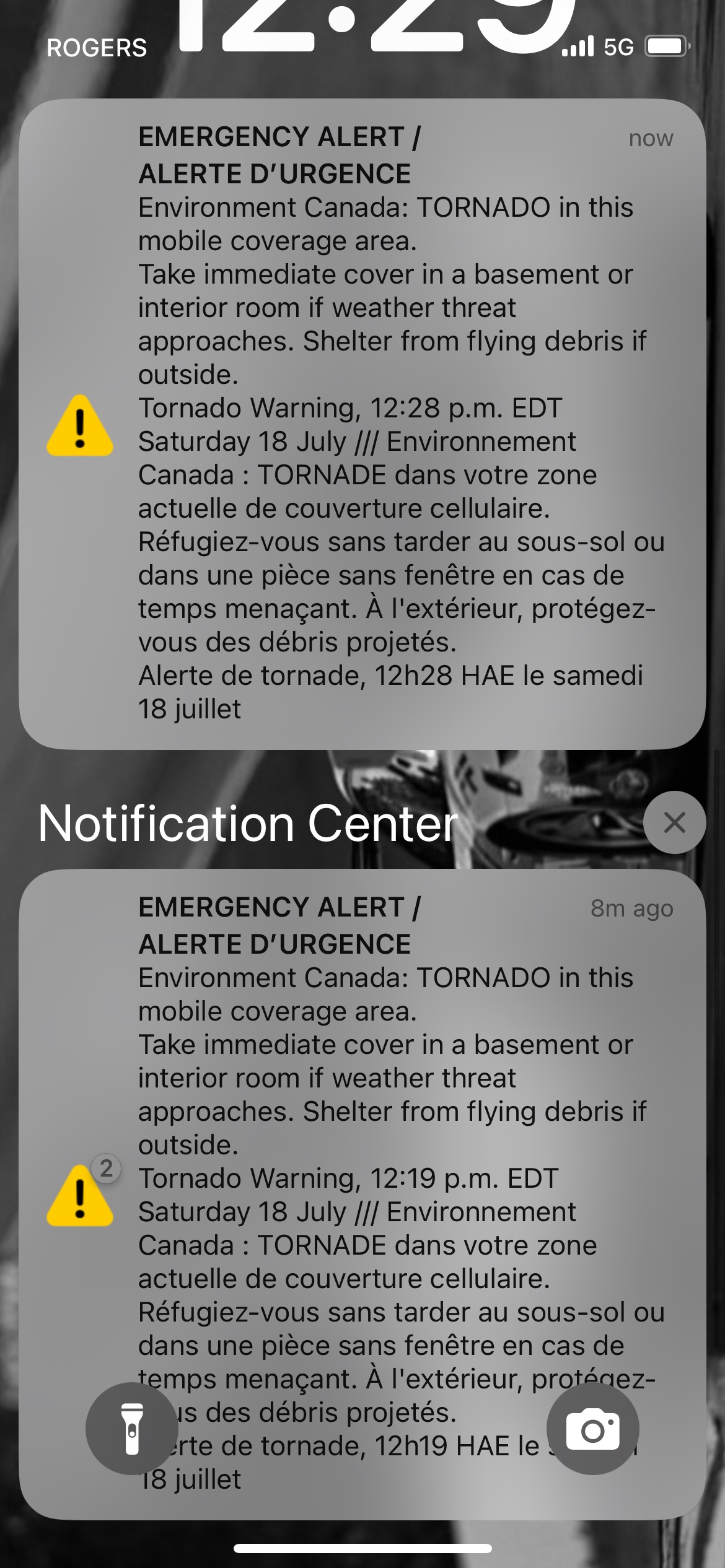
Environment Canada just dropped a red-level tornado warning for Milton, Mississauga, and Oakville. This isn't your standard summer thunderstorm alert where you just shrug and run to close the car windows. Meteorologists are actively tracking a severe, dangerous system capable of producing an actual tornado right now.
If you're in Halton or Peel region, you need to know exactly what's happening and what to do before the sky turns green.
The Details on the Storm Path
At around 12:20 p.m. on Saturday, July 18, 2026, Environment Canada confirmed they are tracking a severe thunderstorm just east of Milton. The cell is tracking southeast at about 40 km/h, aiming straight for high-density pockets in Mississauga and Oakville.
This isn't a slow, lazy system. It packs localized wind gusts reaching up to 90 km/h and heavy downpours dropping 15 to 30 mm of rain in a very short window. The threat level is officially clocked as extreme. Because it's moving fast through urban and suburban neighborhoods, your window to react is narrow.
The storm has already disrupted major local events. The City of Brampton had to delay its Canada Celebrates the FIFA World Cup 2026 community activation event because of the sudden threat.
Why Southern Ontario Tornadoes are Deceptive
Most people think tornadoes only happen in the regular flatlands of America's midwest. That's a massive mistake. Southern Ontario gets its fair share of twisters, but our landscape makes them harder to spot.
Because of the high humidity and local lake effects, tornadoes here are frequently rain-wrapped. You won't see a clean, classic funnel cloud cutting across the horizon like you see in the movies. Instead, it looks like a solid wall of gray or dark water moving toward you. By the time you realize it's a tornado, the winds are already tearing at your shingles.
Add in the fact that Toronto and the Greater Toronto Area are already dealing with a yellow-level air quality alert today due to lingering wildfire smoke from northwestern Ontario. The hazy, choked-out sky makes visibility even worse, hiding the usual visual cues of a severe rotating storm.
Exactly What to Do Right Now
Stop looking out the window. If you're in the warning zone, follow these steps immediately to protect yourself.
If You're in a House or Building
- Head to the basement. Don't wait for the sirens or the wind to pick up.
- Find an interior room. If you don't have a basement, get to the lowest level possible and put as many walls between you and the outside as you can. A bathroom, closet, or hallway works best.
- Stay away from glass. Windows will shatter instantly if flying debris hits them.
- Protect your head. Grab a mattress, thick blankets, or even a hockey helmet for the kids.
If You're in a Car or Outdoors
- Do not try to outrun it. Cars are death traps in a tornado. Seek shelter in a sturdy building immediately.
- Avoid highway overpasses. People think hiding under a bridge is safe. It actually creates a wind-tunnel effect, speeding up the debris and making it much more dangerous.
- Find a ditch. If you're completely stuck outside with zero shelter, find a low-lying ditch, lie completely flat, face down, and cover your head with your hands.
If You're Out on the Water
- Get to shore immediately. Lake Ontario and local conservation waters are highly volatile during severe weather.
- Put on your lifejacket. If you can't reach the shore in time, put your lifejacket on, lie face down in the boat, and protect your head.
Monitor local updates via Environment Canada or use the social media hashtag #ONStorm to report conditions if it is safe to do so. Keep your phone charged and stay away from windows until the red alert officially clears.